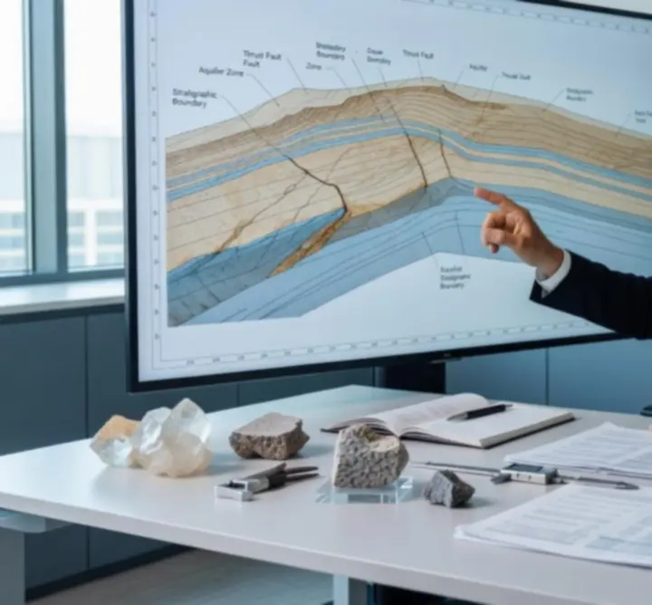
Methodology & Delivery Framework

Our Technical Approach to Geoscience and Engineering Risk

We employ a scientifically rigorous, multi-stage approach tailored to the unique geoscientific and engineering needs of each project. Our strategy integrates field data, advanced modelling, and stakeholder collaboration to ensure robust, actionable outcomes.

From Site Investigation to Decision-Ready Insight

PIRAN GEOSCIENCE LTD structures every commission around clear technical objectives, disciplined data acquisition, and traceable interpretation. Each stage is documented, peer-reviewed where appropriate, and benchmarked against relevant UK and international standards.

End-to-end project governance

Our methodology is designed to reduce geological uncertainty, de-risk capital programmes, and provide regulators, investors, and project teams with confidence in the subsurface conditions that matter most.

Core Stages of Our Methodology

Each engagement follows a structured yet adaptable sequence of activities, ensuring that site-specific conditions, regulatory drivers, and client risk appetite are fully reflected in the work programme.

Stage 1

Fieldwork & Site Investigation

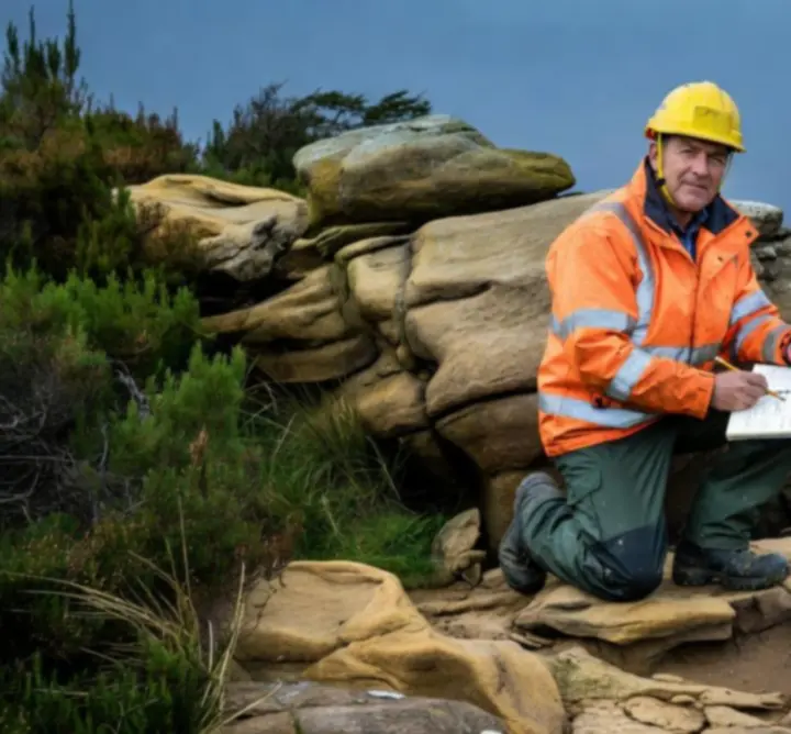
On-site geological surveys and geotechnical diagnostics

Drilling operations and terrain mapping during a geotechnical site investigation

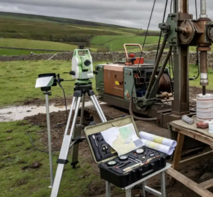
Our specialists conduct comprehensive on-site geological surveys and geotechnical assessments, capturing critical data through direct observation, borehole drilling, sampling, in-situ testing, and terrain mapping. Typical activities include:

  • Engineer-led walkover surveys and structural mapping of outcrops.
  • Borehole, trial pit, and window sampling campaigns aligned with project risk.
  • In-situ testing regimes covering strength, permeability, and deformability.
  • High-resolution terrain and geomorphological mapping to inform design envelopes.
Stage 2

Data Analysis & Modelling

Evidence-based subsurface characterisation

We synthesise field and laboratory data using state-of-the-art subsurface modelling software to deliver precise, evidence-based recommendations tailored to client objectives. Our analytical workflows typically span:

  • Integration of geological, geotechnical, hydrogeological, and environmental datasets.
  • 3D ground models and cross-section development to quantify uncertainty.
  • Deterministic and probabilistic slope, foundation, and retaining structure analyses.
  • Scenario testing to evaluate design options and mitigation measures.
Stage 3

Quality Assurance & Compliance

Standards-led technical governance

Each phase is subject to stringent quality controls and conforms to relevant UK and international standards, ensuring client confidence and regulatory compliance. Our QA framework encompasses:

  • Project-specific Quality Plans with defined hold points and review gates.
  • Application of BS, BS EN, Eurocode, CIRIA, and industry guidance as appropriate.
  • Internal technical review and, where required, third-party verification.
  • Traceable data management and auditable decision records.
Stage 4

Collaborative Project Management

Integrated geoscience and engineering delivery

Dedicated project teams, including principal geoscientists and engineers, maintain transparent communication, coordinate multidisciplinary tasks, and adapt agilely to evolving site conditions.

  • Single point of accountability for scope, programme, and budget.
  • Structured interface management with design teams, contractors, and regulators.
  • Risk registers updated as new ground information is generated.
  • Change control processes that protect both safety and commercial outcomes.

Client Engagement & Communication

From initial enquiry through to project close-out, clients benefit from clear lines of communication, predictable reporting rhythms, and secure access to technical information.

Client Engagement Process

Structured from first contact to final deliverable

From initial enquiry to project delivery, we provide clear communication, progress updates, and access to documentation through secure digital platforms. Typical touchpoints include:

  • Clarification of objectives, constraints, and risk tolerance at project inception.
  • Issue of a concise scope and methodology proposal aligned to client needs.
  • Regular progress briefings and early flagging of material ground risk issues.
  • Secure portals for sharing drawings, models, logs, test data, and reports.

Transparent Reporting

Decision-ready outputs for all stakeholders

We deliver comprehensive, visually rich technical reports with actionable insights, ensuring clarity and usability for all project stakeholders. Our reporting approach features:

  • Clear articulation of ground models, assumptions, and residual uncertainties.
  • Annotated logs, cross-sections, and model views tailored to non-specialists.
  • Concise executive summaries aligned to project decisions and gateways.
  • Recommendations prioritised by criticality, feasibility, and programme impact.

Further detail on report formats, data standards, and digital deliverables is available on request via the Contact Us page.

Technology, Innovation & Environmental Stewardship

Our practice combines advanced digital tooling with a strong commitment to environmental performance, enabling resilient infrastructure and responsible land development.

Technology & Innovation

Cutting-edge tools for deeper subsurface insight

Consultant analysing a geological cross-section and subsurface model

We leverage cutting-edge remote sensing, GIS, and data analytics, elevating the accuracy and depth of our assessments. Our digital toolkit supports:

  • High-resolution remote sensing and aerial datasets for terrain and hazard mapping.
  • GIS-based integration of historical, regulatory, and newly acquired data.
  • Advanced visualisation of cross-sections and 3D models for design coordination.
  • Data analytics workflows that highlight anomalies, trends, and data gaps.

Environmental Stewardship

Embedding sustainability in geoscience decision-making

Sustainability informs every stage, with strategies to mitigate environmental impacts, preserve ecological integrity, and promote regulatory best practices. This includes:

  • Design of investigation and construction methodologies to minimise disturbance.
  • Identification of ground-related environmental constraints at an early stage.
  • Support for environmental impact studies and permitting documentation.
  • Recommendations that align long-term asset performance with environmental objectives.

Continuous Improvement

Learning-led refinement of our methods

Our commitment to ongoing learning, process refinement, and incorporation of the latest scientific research drives project excellence and value for clients.

  • Systematic capture of lessons learned from completed and live projects.
  • Active engagement with professional bodies, technical forums, and research outputs.
  • Regular review of internal standards against evolving best practice.
  • Targeted training to maintain a highly competent, multi-disciplinary team.

Industry Case Studies

Explore real-world examples where our advanced methodologies have enabled successful outcomes in infrastructure, energy, and construction projects.

Our casework demonstrates how structured investigation, disciplined modelling, and transparent reporting translate into reduced uncertainty, optimised design, and more predictable delivery. Each project narrative highlights:

  • Initial ground risk profile and key technical questions.
  • Investigation and modelling strategies selected to address those risks.
  • Interactions with regulators, designers, and contractors.
  • Resulting changes to design, programme, or cost exposure.

Methodology in Practice

Our approach is further documented through technical notes, guidance summaries, and project spotlights.

  • Discipline-specific methodologies detailed on the Expertise page.
  • Downloadable checklists, templates, and briefing papers within Resources.
  • Commentary on evolving standards and regulation on our Insights page.

Align Our Methodology with Your Project

Whether you are scoping an early-stage feasibility study or de-risking a live construction programme, PIRAN GEOSCIENCE LTD can tailor this methodology to your specific requirements and governance needs.