Specialist Geoscience & Engineering

Specialist Geoscience & Engineering Expertise

PIRAN GEOSCIENCE LTD provides rigorous, data-driven insight for the United Kingdom's infrastructure, energy, and construction sectors. Our consultants combine field experience, analytical capability, and scientific discipline to de-risk complex ground conditions.

Core Geoscience Domains

Our work spans the full project lifecycle – from early feasibility and site selection to design, construction, and long-term asset performance.

Field Investigation

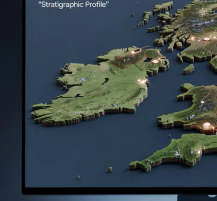
Geological Surveying

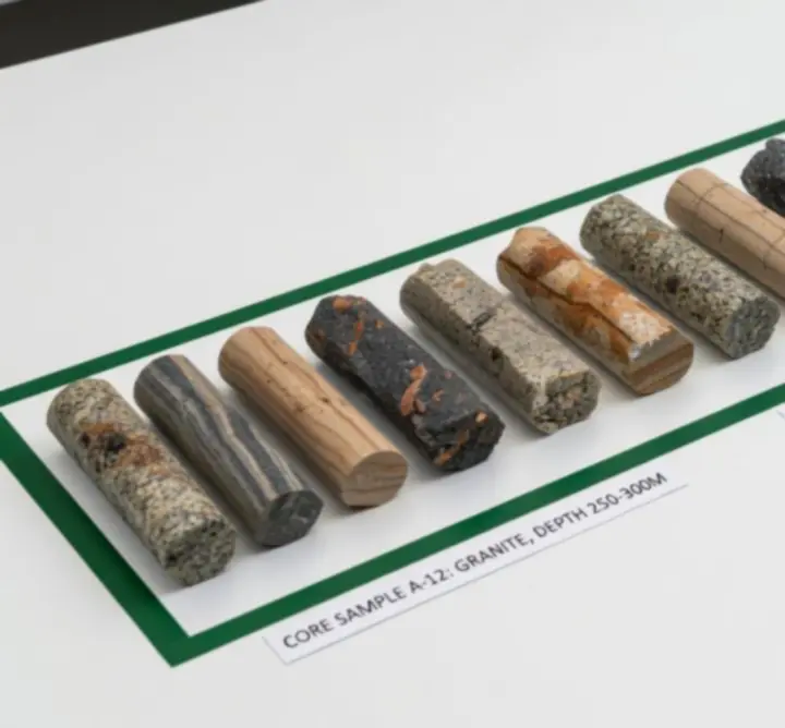
Comprehensive characterisation of site geology and structure.

Geological field mapping on a UK site

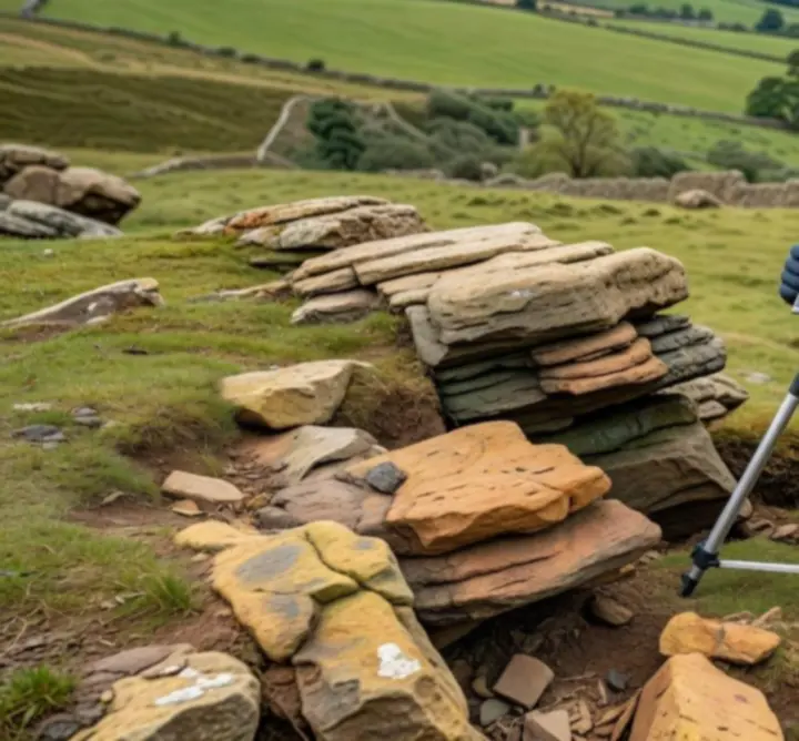
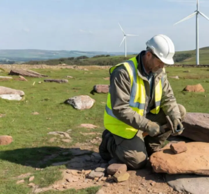
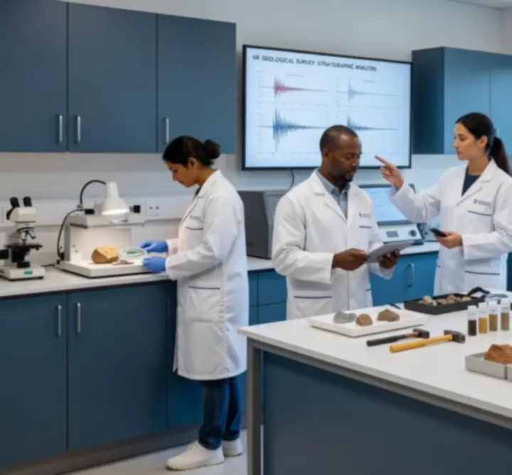
We deliver rigorous site investigations using state-of-the-art equipment, systematic field mapping, and targeted sample collection. Our teams document lithology, structure, weathering profiles, and geomorphology to provide a defensible geological model tailored to each project.

  • Detailed outcrop and structural mapping
  • Rock mass characterisation and discontinuity surveys
  • Logged sample suites for laboratory testing
Geotechnical Engineering

Geotechnical Assessments

Soil and rock strength evaluations for safe, efficient design.

Rock core sample prepared for geotechnical analysis

Our geotechnical assessments provide quantified parameters for foundation, retaining structure, and slope stability design. We integrate core logging, in situ testing, and laboratory programmes to support robust engineering decisions.

  • Derivation of characteristic design parameters
  • Bearing capacity and settlement assessments
  • Slope stability and ground movement analysis
Environmental Geoscience

Environmental Impact Studies

Evidence-based support for regulatory compliance and sustainability.

We prepare detailed environmental impact studies that address geology, hydrogeology, and ground-related risk pathways. Our work supports planning submissions and stakeholder engagement for projects across the UK.

  • Baseline geological and hydrogeological conditions
  • Assessment of potential contaminant linkages
  • Mitigation measures aligned with UK guidance

Subsurface Modelling & Remote Sensing

Advanced 3D models and spatial analysis convert raw data into decision-ready insight, allowing project teams to anticipate and manage ground risk.

Subsurface Modelling

Three-dimensional representation of complex ground conditions.

3D terrain and subsurface mapping diagram

We construct 3D terrain and subsurface models that integrate borehole logs, geophysical datasets, and geological mapping. These models quantify uncertainty and support engineering design, risk mitigation, and resource evaluation.

  • Integrated stratigraphic and structural frameworks
  • Scenario testing for alternative design options
  • Explicit representation of hazards and interfaces

Remote Sensing & GIS

Spatial data and satellite imagery for informed site appraisal.

We leverage satellite imagery, aerial photography, and GIS datasets to characterise terrain, identify geomorphological features, and support early-stage site screening. This front-loads knowledge and refines intrusive investigation strategies.

  • Desktop constraints mapping and hazard screening
  • Digital elevation and slope analysis
  • Spatial integration with ground investigation data
Interpretation

Cross-Section Interpretation

Clear visualisation of subsurface conditions for engineers and stakeholders.

Geological cross-section illustrating subsurface layers

We develop precise geological cross-sections that communicate ground models to multidisciplinary teams. These visuals link conceptual understanding to design outputs, highlighting controlling structures, interfaces, and uncertainties.

  • Engineer-ready cross-sections and long sections
  • Integration of borehole, geophysical, and mapping data
  • Uncertainty bands and risk-focused annotations

Scientific Advisory & Construction Support

We work alongside design and construction teams to keep projects technically robust, compliant, and buildable.

Scientific Advisory for Infrastructure

Specialist input for complex civil, energy, and transport schemes.

Our consultants provide independent, evidence-based advice throughout design development and option evaluation. We translate detailed ground models into clear implications for infrastructure layout, constructability, and long-term performance.

  • Ground risk registers and mitigation strategies
  • Design review and technical assurance support
  • Stakeholder briefings and expert presentations
Explore our approach

Construction Project Support

On-site geological and geotechnical guidance during delivery.

During construction, we provide responsive technical support to ensure that design assumptions remain valid as new ground information emerges. Our input helps contractors adapt methods safely and efficiently.

  • On-site logging and observational method support
  • Review of unexpected ground conditions
  • Interface management between designers and contractors
View project insights

Commitment to Safety & Quality

Consistent application of UK and international best practice.

Safety and quality are embedded in every stage of our work, from planning field operations to issuing final reports. We operate in alignment with recognised UK standards and project-specific requirements, supporting clients' governance frameworks.

  • Robust risk assessments and method statements
  • Structured internal technical review processes
  • Clear audit trails for assumptions and data sources
Explore technical resources

Data Analysis, Reporting & Case Studies

Our reporting is concise, transparent, and defensible – designed for engineers, planners, regulators, and project sponsors.

Data Analysis & Reporting

Turning complex datasets into actionable engineering parameters.

Consultant analysing geoscience data on multiple screens

We apply rigorous statistical and computational methods to laboratory and field data, generating parameters that accurately reflect uncertainty and variability. Our reports clearly link data, interpretation, and design recommendations.

  • Reproducible workflows for data validation and analysis
  • Transparent presentation of assumptions and limitations
  • Graphical summaries to aid rapid technical review
Case Study

Wind Farm Feasibility

Technical evaluation and modelling enabling project approval.

Geologist assessing ground conditions at a wind farm site

For a proposed UK onshore wind farm, PIRAN GEOSCIENCE LTD undertook an integrated feasibility assessment, combining geological surveying, geotechnical testing, and subsurface modelling to inform turbine layout and foundation concepts.

Focus Area Outcome
Ground model Defined stratigraphy and key structural controls across the site.
Foundation options Optimised concepts aligned with variable rockhead depth and strength.
Risk profile Quantified geotechnical risks, enabling targeted mitigation and stakeholder confidence.

The resulting evidence base supported planning submissions and underpinned commercial decision-making on project phasing.

Read more insights

Technical Team Credentials

Our consultants' academic backgrounds and field experience underpin PIRAN GEOSCIENCE LTD's reputation for robust, defensible advice.

Scientific and Engineering Excellence

Multi-disciplinary expertise across geology, geotechnics, and environmental science.

Technical geoscience team working in a laboratory

Our team comprises chartered geologists, geotechnical engineers, and environmental scientists with extensive experience on UK and international projects. We combine academic rigour with pragmatic site-based understanding.

  • Postgraduate qualifications in applied geology and geotechnical engineering
  • Experience across infrastructure, energy, and complex brownfield sites
  • Active participation in professional bodies and technical working groups

Next step: Explore our specialist services suite or contact us to align our expertise with your project requirements.

How our expertise supports your project

From early feasibility to commissioning, PIRAN GEOSCIENCE LTD integrates geological insight with engineering requirements to reduce uncertainty and control cost.

  • Early identification of ground hazards and constraints
  • Efficient targeting of investigations and testing programmes
  • Robust technical evidence to support planning and approvals
Align services to your needs

Discuss your geoscience and engineering requirements

Whether you are progressing a new infrastructure scheme, evaluating an energy project, or addressing construction-phase ground risks, PIRAN GEOSCIENCE LTD can provide targeted, technically robust support.