Technical Resource Library

Resources for Geoscience & Engineering Decision-Makers

Discover a curated library of technical documents, case studies, and reference materials developed by PIRAN GEOSCIENCE LTD to support robust, evidence-based decisions on UK infrastructure, energy, and construction projects.

Need implementation support? Our consultants can translate any resource into project-specific advice via a dedicated engagement.

Resource coverage

Materials aligned to contemporary UK and international practice.

  • Geotechnical Site investigation protocols and testing guidance.
  • Environmental Impact assessment methods and regulatory context.
  • Subsurface Modelling workflows and uncertainty communication.
  • Infrastructure Use-cases across transport, energy, and civils.
See how our services apply these methods in practice

Resource Library Overview

Our resource library brings together field-tested methodologies, analytical frameworks, and reporting examples produced by our geoscientists and engineers. Every item is written for practitioners who need clarity, traceability, and direct applicability to live projects.

Practitioner-focused content

Resources are structured to support immediate use in scoping, tendering, and delivery, with clear inputs, assumptions, and limitations stated upfront.

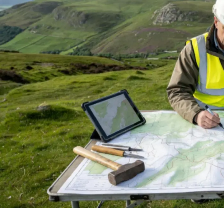
  • Checklists and flow diagrams for fieldwork.
  • Template structures for technical reporting.
  • Worked examples linked to UK ground conditions.

Scientific traceability

Each document references relevant standards, guidance notes, and peer-reviewed literature, ensuring you can defend methods during internal and external scrutiny.

  • Explicit citation of standards and guidance.
  • Statement of analytical methods and data sources.
  • Discussion of uncertainty and sensitivity.

Regularly updated

We periodically review and update materials to reflect changes in regulation, standards, and common geotechnical and environmental practice in the UK.

  • Updates following major standards revisions.
  • New examples from recent infrastructure schemes.
  • Version control and change notes included.

Best Practice Guides

Download up-to-date guidance on geological surveying, intrusive site investigation, and geotechnical testing methodologies tailored to UK ground conditions and regulatory expectations.

Geological Surveying Framework

From desk study to field mapping.

Outlines a systematic approach to geological surveying, combining remote sensing, historic mapping, and targeted field validation to produce a defensible ground model.

  • Desk-based data collation and gap analysis.
  • Field mapping protocols and logging standards.
  • Integration with GIS and 3D subsurface models.

Site Investigation Protocols

Planning and executing intrusive works.

Provides structured guidance on planning, supervising, and reporting intrusive investigations for greenfield and brownfield sites, supporting proportionate data acquisition.

  • Investigation design and borehole spacing logic.
  • Sampling, logging, and in-situ testing requirements.
  • Health, safety, and environmental considerations.

Geotechnical Testing Methodologies

From laboratory to design parameters.

Summarises selection, interpretation, and reporting of geotechnical tests for foundations, slopes, retaining structures, and earthworks, with clear parameter derivation steps.

  • Index, strength, and compressibility testing.
  • Deriving characteristic values and design parameters.
  • Handling non-standard or complex materials.

Looking to embed these guides into your internal procedures or templates? Our consultants can run a focused workshop or develop bespoke standards for your organisation. Contact us to discuss.

Case Studies

Explore real-world applications of our consultancy's expertise across infrastructure and energy schemes, illustrating how robust geoscience and engineering inputs de-risk complex ground conditions.

All case studies are anonymised and generalised where required to preserve client confidentiality while retaining technical insight.

High-resolution terrain mapping visualisation illustrating complex topography for an infrastructure project

Terrain Mapping for Linear Infrastructure

Integrating remote sensing, LiDAR, and targeted ground investigation.

A major UK transport corridor required improved understanding of geomorphology, slope stability, and superficial deposits along a multi-kilometre alignment. We combined terrain modelling with selective intrusive investigation to refine the ground model.

  • High-resolution digital elevation models used to identify slope instability zones.
  • Targeted boreholes and trial pits confirmed depth to rockhead and variability in superficial deposits.
  • Outputs informed earthworks balance, retaining structure design, and drainage strategy.
View related project applications

Ground Risk Management for Energy Infrastructure

Translating complex stratigraphy into clear risk statements.

An energy client needed to site critical infrastructure in an area of variable rockhead and potential karstic features. Using a combination of geophysics, borehole data, and probabilistic modelling, we characterised ground risks and developed mitigation options.

  • Definition of discrete ground risk scenarios with probability ranges.
  • Mapping of uncertainty hotspots to inform further investigation.
  • Recommendations for foundation solutions and monitoring strategies.

This case study is available as a downloadable briefing note, suitable for internal stakeholder communications and risk workshops.

Technical Whitepapers

Access detailed analyses on environmental impact, subsurface modelling, and ground risk quantification, written for technical reviewers, regulators, and design teams working under UK and international frameworks.

Environmental Impact Pathways in Linear Schemes

Aligning geoscience inputs with UK environmental legislation.

Describes how geological and hydrogeological understanding underpins environmental impact assessment for linear infrastructure, with emphasis on groundwater-dependent ecosystems and contaminant migration.

  • Conceptual site models for complex hydrogeology.
  • Interaction with surface water and protected receptors.
  • Evidence expectations from regulators and stakeholders.

Subsurface Modelling & Uncertainty Communication

From deterministic cross-sections to probabilistic ground models.

Explores methods for building, calibrating, and communicating 3D ground models, including approaches for representing uncertainty and data limitations to non-specialists.

  • Model inputs, verification, and sensitivity testing.
  • Visual communication of uncertainty in 3D models.
  • Implications for design contingency and risk allocation.

Ground Risk & Regulatory Expectations

Navigating contemporary UK standards and guidance.

Provides a structured overview of current expectations from UK regulators, funders, and asset owners regarding ground risk identification, assessment, and mitigation documentation.

  • Ground risk registers and reporting conventions.
  • Interfaces with planning, environmental, and safety regimes.
  • Good-practice examples for audit-ready documentation.

Sample Project Reports

Review anonymised example reports that demonstrate our approach to clear, evidence-based communication across geotechnical, geological, and environmental commissions.

Samples are illustrative and do not contain live client data. They are designed to showcase structure, depth of analysis, and clarity of recommendations.

Close-up of rock core samples laid out for detailed geotechnical analysis and logging

Geotechnical Investigation Report

Foundation design for a mid-rise structure.

Illustrates our standard structure for reporting an intrusive ground investigation, including logging, laboratory testing, parameter selection, and design recommendations.

  • Consistent borehole logs and core photography references.
  • Traceable derivation of characteristic values.
  • Clear mapping from ground model to design advice.

Combined Geological & Environmental Statement

Supporting planning and stakeholder engagement.

Shows how we integrate geological, hydrogeological, and environmental data into a single, coherent narrative for planning submissions and stakeholder review.

  • Executive summaries for non-technical readers.
  • Detailed technical appendices with data and methods.
  • Visual summaries of key constraints and opportunities.

Interactive Data Sets

Engage with downloadable site data, terrain mapping files, and 3D model excerpts that demonstrate our analytical workflows and data structures.

Sample data packages

Each package contains a concise read-me file, data dictionary, and example visual outputs to help your team quickly understand structure, formats, and intended uses.

Package Focus Typical formats
Terrain & Surface Model Excerpt Topography, slopes, and derived geomorphological indicators. GeoTIFF, XYZ, shapefiles.
Intrusive Investigation Dataset Borehole records, tests, and interpreted stratigraphy. CSV, AGS-style tables, PDF logs.
3D Ground Model Snapshot Layer surfaces and volumes for design interfaces. Exchange formats and 3D viewer files.

Request access

To ensure appropriate use and context, data packages are available on request. Access can be granted as part of a live commission or under a separate data-use agreement.

  • Clarify intended use (training, research, system testing).
  • Confirm software environment and preferred formats.
  • Agree attribution and redistribution terms.
Request a sample dataset

For ongoing collaborations, we can configure recurring data drops or shared workspace integration.

Find direct references to current British and international standards relevant to geoscience and engineering projects. Always refer to the latest official publications for definitive requirements.

British & European references

  • British Standards and Eurocodes relevant to ground investigation, geotechnical design, and environmental assessment (available via official standards organisations and licensed distributors).
  • Guidance documents from UK professional bodies and institutions covering good practice in ground engineering and environmental risk assessment.
  • Regulatory guidance from environment and planning regulators describing expectations for environmental impact assessment and land contamination management.

Access typically requires appropriate organisational subscriptions or procurement through authorised channels.

International & sector guidance

  • International standards relevant to ground characterisation, laboratory testing, and data reporting, where applicable to UK practice.
  • Sector-specific guidance for transport, energy, and major project delivery relating to ground risk management and assurance.
  • Technical notes and industry reports outlining emergent methods, digital workflows, and best practice trends.

Our whitepapers and guides reference specific clauses and sections where relevant. For project-critical decisions, always cross-check against the latest official version and project-specific requirements.

Expert Webinars & Workshops

Register or download content from our latest online events led by principal consultants, focused on practical, project-tested approaches to ground risk, investigation planning, and data-led decision-making.

Sessions are designed for engineering managers, technical reviewers, and project sponsors who need concise, evidence-based insights.

Panel of geoscience consultants discussing project data during a live technical webinar

Featured session: Ground Risk in Infrastructure Delivery

A 60-minute webinar discussing how to integrate ground risk thinking from feasibility through detailed design, with real examples from UK transport and energy schemes.

  • Designing proportionate investigation strategies.
  • Communicating uncertainty to decision-makers.
  • Aligning documentation with assurance processes.

Workshop series: Data Workflows in Ground Engineering

Interactive, small-group sessions focused on building robust data pipelines from field capture through to modelling and reporting.

  • Structuring investigation data for re-use.
  • Linking GIS, modelling software, and reporting tools.
  • Implementing quality control and audit trails.
Arrange a private workshop

FAQ: Resource Access

Below are responses to common questions about how our resources can be used, cited, and incorporated into your internal documentation and workflows.

Need project-specific interpretation?

Our resources provide a strong technical foundation, but effective decisions depend on project context. Engage our consultants to interpret data, tailor methods, and support assurance for your scheme.