Technical Commentary & Sector Intelligence

Insights shaping tomorrow’s ground and infrastructure decisions

Evidence-based analysis, regulatory intelligence and technical perspectives from PIRAN GEOSCIENCE LTD consultants, focused on the challenges facing UK infrastructure, energy and construction projects.

Latest industry insights

A concise view of recent developments in geoscience, geotechnical engineering and environmental consultancy, focused on the implications for asset owners, developers and contractors across the UK.

Market Outlook

Ground risk in a constrained planning environment

How robust site investigation and subsurface modelling are de-risking complex urban regeneration schemes.

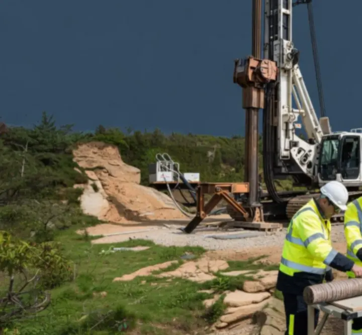
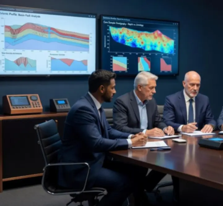
Across the UK, brownfield intensification and constrained urban plots are exposing legacy contamination, variable made ground and complex groundwater regimes. Projects that treat ground risk as a late-stage technical issue typically encounter programme delays, redesign cycles and claims exposure.

PIRAN GEOSCIENCE LTD is supporting clients to front-load geoscience input, integrating geotechnical zoning, 3D subsurface models and groundwater conceptual site models into early design gateways. This approach enables more predictable foundation strategies, optimised earthworks and clearer allocation of risk in construction contracts.

Explore our geotechnical and environmental services
Environmental & ESG

Aligning environmental impact studies with emerging ESG expectations

Translating regulatory compliance into credible, data-backed sustainability narratives for investors and stakeholders.

Environmental Impact Assessments (EIAs) and related studies are increasingly scrutinised not only by regulators, but also by lenders, insurers and ESG rating agencies. Narrative-heavy reports unsupported by traceable data are being challenged more frequently during due diligence.

Our teams combine rigorous baseline data acquisition, transparent modelling assumptions and clear uncertainty statements to deliver environmental documentation that stands up to technical and commercial review. This provides clients with an audit-ready evidence trail when engaging with funders and statutory consultees.

See how we structure evidence-led advisory

Delivering integrated subsurface modelling, site investigation and advisory services for a high-value UK infrastructure scheme.

Subsurface geological model visualisation for a major UK infrastructure project.

Strategic transport corridor realignment – UK client

PIRAN GEOSCIENCE LTD was appointed by a major UK infrastructure promoter to support the realignment of a strategic transport corridor traversing variable bedrock, historical mining features and sensitive groundwater receptors.

Technical scope

  • Desk-based review of legacy borehole, mining and geological datasets.
  • Design and supervision of targeted intrusive ground investigation.
  • Construction of an integrated 3D subsurface model.
  • Geotechnical zoning for earthworks, structures and cuttings.
  • Hydrogeological assessment and groundwater monitoring.

Outcomes delivered

  • Reduction in provisional sums associated with ground risk.
  • Optimised alignment to avoid zones of highest geohazard.
  • Refined foundation solutions informed by modelled strata continuity.
  • Improved confidence for stakeholders at statutory consultation.

Value-added consultancy: By combining high-resolution subsurface modelling with disciplined uncertainty mapping, we enabled our client to negotiate more balanced risk allocations with delivery partners, reducing contingency while maintaining resilience to ground-related change.

Expert panel commentary

Senior consultants from PIRAN GEOSCIENCE LTD share practical responses to current challenges in construction geology and environmental impact assessment.

Expert panel of geoscience consultants discussing construction geology challenges.

Managing construction risk where geology and programme collide

Panel focus: Early contractor involvement is increasingly framed around cost and logistics, yet ground risk frequently remains under-characterised when key decisions are made on sequencing and temporary works.

Our panellists stress the importance of translating technical findings into clear, construction-focused risk registers. That means expressing geotechnical uncertainty in terms of potential excavation overbreak, support requirements, spoil classification and dewatering effort rather than purely in terms of laboratory-derived parameters.

By positioning geoscience advisors at the interface between designers, planners and site teams, we have seen material reductions in unplanned variations, improved constructability decisions and greater traceability in the event of claims or disputes.

Environmental impact studies that stand up to scrutiny

Panel focus: With increasing public and regulatory attention on biodiversity, groundwater protection and land quality, EIA documentation is being challenged at a much higher technical resolution.

Our experts advocate for a “line of sight” approach: every conclusion within the environmental assessment should be traceable back to a specific dataset, methodology or model assumption. Sensitivity testing and explicit presentation of data gaps support more resilient decision-making and reduce the risk of late-stage objections.

Regulatory updates & policy briefings

Concise interpretations of regulatory and policy change affecting UK and international geotechnical and environmental projects.

Planning and environmental regimes – practical implications for ground investigations

Revisions to planning and environmental regimes across the UK are placing greater emphasis on early identification of geohazards, contamination and potential impacts on controlled waters. While the underlying technical standards remain familiar, expectations around transparency, stakeholder engagement and digital reporting continue to rise.

PIRAN GEOSCIENCE LTD supports clients by aligning investigation strategies with current guidance, ensuring that borehole logs, monitoring data and interpretative reports are structured to satisfy both regulatory submissions and internal governance requirements.

International considerations for cross-border infrastructure portfolios

For clients with assets across multiple jurisdictions, reconciling different geotechnical codes, groundwater protection frameworks and environmental impact procedures can be challenging. Our advisory services focus on mapping local requirements against the client’s internal technical standards, identifying where additional assurance is needed.

We consolidate regulatory expectations into concise policy briefings, enabling project sponsors to make consistent, defensible decisions across markets while maintaining compliance with local authorities.

Emerging technologies in geoscience

How advances in remote sensing, data analytics and terrain mapping are improving certainty and value in infrastructure and energy projects.

From discrete boreholes to continuous models

Traditional investigation strategies rely heavily on a relatively sparse grid of boreholes. While essential, these provide only point data. Modern workflows integrate remote sensing, geophysical surveys and legacy datasets into continuous 3D subsurface models, with uncertainty visualised alongside lithological interpretations.

For asset owners, the key benefit is not aesthetic visualisation, but the ability to test “what if” scenarios and communicate residual risk in a way that can be understood by multidisciplinary project teams.

Terrain mapping and digital twins of ground conditions

High-resolution terrain mapping and the development of ground-related digital twins support more robust decisions on slope stability, drainage and earthworks balance. When linked to monitoring data, these models provide an early warning capability for asset performance and potential ground movement.

Our consultants help clients select proportionate technologies, balancing data richness, programme constraints and regulatory acceptance.

Sustainability spotlight

Integrating environmentally responsible geoscience and engineering approaches without compromising constructability or programme.

Optimising material reuse and earthworks balance

Optimised earthworks strategies, underpinned by robust geotechnical characterisation and contamination assessments, can significantly reduce off-site disposal and imported fill. This translates directly into lower embodied carbon and reduced traffic movements.

Protecting groundwater and surface water receptors

Our hydrogeologists design monitoring and mitigation measures that protect sensitive receptors while allowing construction to proceed with confidence. Clear conceptual site models support proportionate, defensible mitigation strategies.

Embedding sustainability into technical specifications

We work with design teams to reflect sustainable ground engineering principles within specifications and employer’s requirements, ensuring that environmental objectives are measurable and contractually visible.

Client success stories

First-hand accounts from clients who have benefited from our scientific rigour, transparent reporting and tailored problem-solving.

“The clarity of PIRAN GEOSCIENCE LTD’s subsurface model enabled us to de-risk a complex foundation package before tender. Their ability to communicate uncertainty and residual risk in plain language significantly improved our engagement with both contractors and insurers.”

Programme Director, UK Transport Client

“Their environmental and geotechnical teams worked as a single unit. The resulting impact assessments and ground strategy were coherent, technically robust and accepted by regulators without iteration.”

Technical Lead, Energy Infrastructure Developer

Thought leadership publications

Technical notes, whitepapers and research articles authored by PIRAN GEOSCIENCE LTD specialists.

Theme Focus Intended audience
Subsurface uncertainty Quantifying and communicating uncertainty in 3D ground models for major infrastructure schemes. Project directors, technical authorities, risk managers.
Groundwater & infrastructure Designing monitoring and mitigation strategies for linear transport assets in sensitive hydrogeological settings. Hydrogeologists, environmental managers, asset owners.
Contaminated land Integrating land quality assessment with geotechnical design for brownfield redevelopment. Developers, consulting engineers, remediation specialists.

A curated selection of publications will be made available via our Resources page, including downloadable technical notes and project summaries.

Fieldwork journal

An operational view of current geological surveying, rock core logging and terrain mapping campaigns led by our technical teams.

Geoscience team conducting geological surveying and core logging in the field.

From field observation to design input

Our field operations connect high-quality observation with robust data capture workflows. Geologists and engineers document structural features, lithological changes and hydrogeological conditions, feeding directly into digital logs and subsurface models.

Typical activities include:

  • Outcrop and exposure mapping to validate desk-based interpretations.
  • Supervision of drilling and sampling, including core orientation and detailed logging.
  • Installation and monitoring of piezometers and gas monitoring installations.
  • Terrain and geomorphological mapping to support stability assessments.

Field records are quality-assured and integrated with laboratory data, ensuring that design teams receive a coherent, traceable dataset.

Learn how we structure our site investigation workflow

Resource library

Datasheets, checklists and guidance materials to support project planning, compliance and best practice.

Ground investigation scoping checklist

A structured set of prompts to ensure that conceptual ground models, constraints and information gaps are understood before scoping intrusive works.

Construction-phase monitoring guide

Summary guidance on designing proportionate geotechnical and environmental monitoring regimes during construction.

Regulatory submission data pack structure

Recommended structure for supporting datasets accompanying planning and environmental submissions.

Interactive Q&A

Submit geoscience and engineering questions to our consultants and explore responses to frequently raised queries.

Submit a question

Use the form below to outline your query. We aim to respond with a concise, technically robust perspective, and may suggest a follow-up discussion where projects are complex or commercially sensitive.

For commercially sensitive queries, please avoid including confidential information. A member of our team will arrange a direct conversation where appropriate.

Recent questions addressed

  • How much investigation is “enough” for a complex brownfield site?

    We recommend scoping investigations based on decision points rather than fixed drill metre totals, aligning data collection with specific design and permitting questions.

  • Can subsurface models be relied upon for contractual risk allocation?

    Yes, provided that uncertainty is explicitly represented and the limitations of the model are acknowledged in tender documentation and risk registers.

  • How early should hydrogeological input be commissioned?

    Engaging hydrogeologists during site selection and early concept design can significantly reduce later design iterations and regulator queries.